
English| EUR
Suggested for you
More currencies
Choose a language
Navigating the steep streets and historic squares of Galicia's largest city requires a clear orientation strategy. A reliable local route document provides the necessary layout to explore the historic quarter and waterfront efficiently.
Quick answer
You can download a vigo walking tour map pdf guide from the official tourism portal or collect a physical copy at the tourist office on Rúa López de Neira 8. The office operates daily from 10:00 to 17:00 with zero entry fees. Arriving between 10:00 and 16:00 ensures access to staff before closing procedures begin.
Vigo is built on a series of steep inclines rising directly from the Atlantic Ocean, making pre-planning essential for pedestrian navigation. Utilizing a vigo walking tour map pdf allows visitors to chart a course that minimizes uphill climbs while connecting the major municipal landmarks. The city's topography separates the modern commercial districts from the older maritime neighborhoods, creating distinct zones that require strategic routing. A downloaded or printed layout helps identify public escalators and elevators installed in recent years, such as the prominent Halo elevator and the Camelias funicular, which bridge significant elevation gaps between the lower port area and the upper avenues. Understanding this vertical layout prevents fatigue and ensures steady progress through the central corridors, especially during the warmer summer months. The historic center, known locally as the Casco Vello, presents a dense network of granite-paved alleys that predate modern urban grid planning. Navigating this sector with a reliable self-guided walking route reveals sloping squares like Praza da Constitución and structural monuments such as the neoclassical Concatedral de Santa María. Because the medieval street pattern rarely follows a straight line, relying solely on cellular data signals between tall stone structures can occasionally lead to temporary misdirection. Having a static digital or physical document provides continuous orientation regardless of connectivity. Route markers indicated on these documents often highlight points of specific architectural interest, guiding pedestrians from the coastal maritime station, past the seafood markets, and up toward the commercial artery of Porta do Sol without missing the transitional stone architecture. Beyond the immediate old town, comprehensive route materials outline paths to peripheral sites of historical significance and panoramic viewpoints. A printable Vigo sightseeing guide typically includes the winding pedestrian ascents to O Castro fortress, the seventeenth-century defensive position offering expansive views over the Ría de Vigo and the distant Cíes Islands. These broader overviews establish the critical spatial relationship between the bustling, modern Ensanche district and the quieter, elevated parklands scattered across Mount Castro. By consulting a vigo walking tour map pdf prior to departure, travelers can effectively group adjacent neighborhoods into manageable daily excursions. This preparation ensures they locate the official municipal tourist information services on Rúa López de Neira to verify any seasonal route changes before beginning their primary urban exploration.
“The city's topography separates the modern commercial districts from the older maritime neighborhoods, creating distinct zones that require strategic routing.”
A half-day walking tour using a PDF map typically covers Vigo's historic center and waterfront in 3–4 hours. This itinerary suits visitors who want flexibility to pause at key landmarks while following a self-guided route.
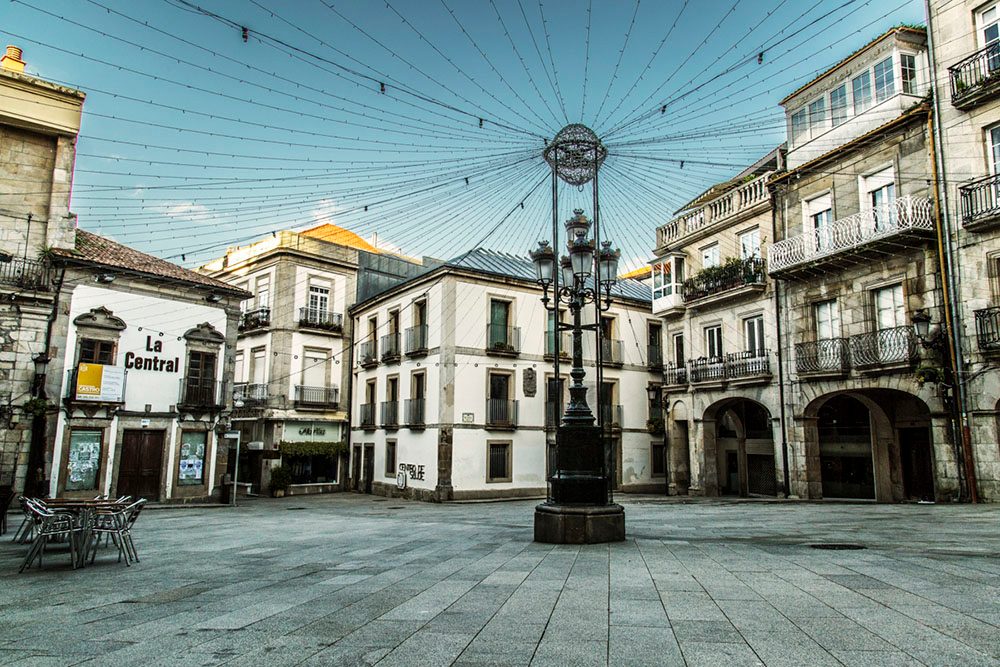
Begin at this central square, orient yourself with your map, and identify the main routes radiating toward the old town and port. Allow 10 minutes for planning.
Walk the narrow streets of the historic quarter, visiting Plaza de la Constitución and the Collegiate Church. Budget 60–75 minutes for this zone.
Follow your map downhill to the working harbor and Paseo Marítimo, where you can observe maritime activity and seafood markets. Allocate 30–40 minutes.
Climb to Castelo de San Sebastián or the nearby hillside parks marked on most tour maps for panoramic views over the ría. Plan 45 minutes including the ascent.
Walk back through the shopping district on Rúa do Príncipe, stopping at cafés or the Mercado da Pedra if your map highlights it. Reserve 30 minutes for this leg.
End at Rúa López de Neira 8 to collect updated maps, ask questions, or confirm onward plans before the office becomes less staffed later in the day.
The central office for obtaining your Vigo walking tour map is located at Rúa López de Neira 8, situated in the heart of the city near the main commercial and historic districts. Visitors arriving by public transport or on foot will find the office centrally positioned for easy access before beginning a self-guided route.
Vitrasa lines stopping at Policarpo Sanz or Colón
Renfe to Vigo-Guixar Station
From the Port of Vigo (Transatlantic Quay)
Local taxi rank to Rúa López de Neira 8
Plan your arrival for the best arrival window of 10:00–16:00 to ensure tourist information staff are available to assist with your map request. If driving, utilize the nearby public underground parking garages, as street parking in the city center is limited.
The tourism office is open daily to assist visitors with their Vigo walking tour map PDF and other travel inquiries. Staff are available throughout the week to provide resources for your self-guided exploration of the city.
Access to self-guided tour resources and tourist information services in Vigo is provided at no cost. Visitors can obtain maps and guides without any entry fees.
Verdict: Adults pay 0 EUR for walking tour maps, as all official information services are provided free of charge.
The best arrival window for your self-guided walking tour is between 10:00 and 16:00. This timeframe balances comfortable local weather with access to tourist information staff for map inquiries.
—
Quiet streets allow for easier navigation of your PDF route during these hours.
Mild with average highs near 20°C
Pleasant temperatures provide optimal conditions for exploring the city center on foot.
Cooler with average highs near 18°C
These months avoid the peak summer heat and high tourist volume of July and August.
Verdict: Plan your visit between 10:00 and 16:00 during the months of May, June, September, or October for the most comfortable walking experience.
Everything you need to know about vigo walking tour map pdf
You can find a vigo walking tour map pdf on the official tourism website of Vigo. This resource provides a comprehensive layout of the city's key points of interest for independent explorers.
The entrance fee for accessing information services and self-guided tour resources is 0 EUR. This allows you to plan your route through the city without additional costs.
To get the most out of your vigo walking tour map pdf, start at the city center and follow the suggested historical path. You can pause at any of the cultural sites or plazas along your route.
While the vigo walking tour map pdf is available digitally, you can visit the tourist information office at Rúa López de Neira 8 for printed materials. The office is open daily from 10:00 to 17:00 to assist visitors.
Yes, the paths marked on the vigo walking tour map pdf are generally accessible for families. You can explore public squares, coastal areas, and local markets at your own pace.
During the summer months, it is best to consult your vigo walking tour map pdf early in the day. Aim to visit between 10:00 and 16:00 to avoid mid-day heat and large groups.
The tourist information office is located at Rúa López de Neira 8, 36202 Vigo. You can reach the staff for inquiries at +34 986 224 757 during standard opening hours.
Yes, the guide highlights essential sites such as the Casco Vello, O Berbés, and the harbor area. These landmarks reflect the maritime heritage and architectural history of this Galician port city.