
English| EUR
Suggested for you
More currencies
Choose a language
Tracing the maritime history and medieval architecture of Galicia's largest city requires a solid sense of direction. A well-planned vigo walking tour map helps visitors connect the bustling port with the elevated historic district.
Quick answer
The standard public routes on a vigo walking tour map guide visitors through the Casco Vello, starting near the port and ending at elevated points like the Castro Fortress. The route is accessible 24 hours a day, Monday through Sunday, with a 0 EUR entrance fee. Arriving between 09:00 and 11:00 ensures cooler temperatures while navigating the steep coastal topography.
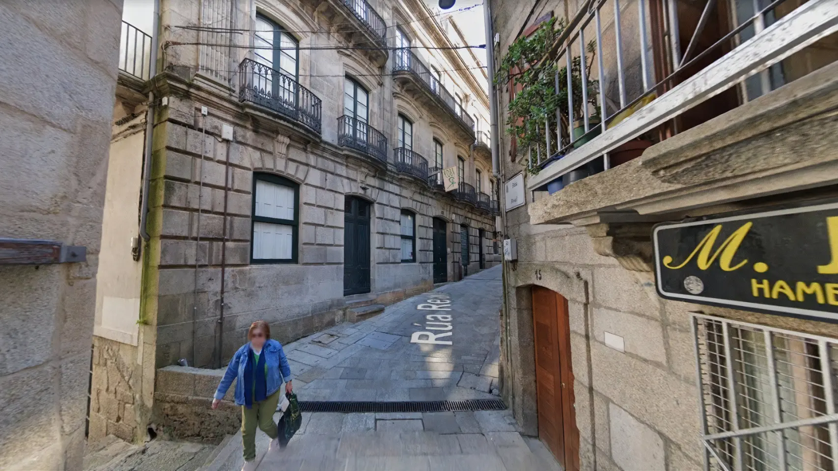
Vigo’s historic center is built on a steep incline rising directly from the Atlantic Ocean, making navigation far more vertical than typical European pedestrian zones. For first-time visitors, securing a reliable vigo walking tour map is essential for plotting a logical course through the layered city streets. Most self-guided routes begin near the maritime station, where transatlantic ships dock, before moving inland toward the lower bounds of the historic quarter. From the waterfront, pathways lead up into a network of granite-paved alleys that define the city's architectural heritage. Understanding this topography prevents unnecessary backtracking up steep staircases and allows walkers to conserve energy for the upper viewpoints overlooking the expansive Ría de Vigo. A structured progression through the city highlights distinct chapters of Galician history. The core of any pedestrian exploration is the Casco Vello, located at 36202 Vigo, Pontevedra. Here, narrow passages open into enclosed squares like the Praza da Constitución, historically the commercial heart of the settlement. Nearby, the famous Rúa das Ostras functions as a traditional hub where local vendors prepare fresh oysters daily. Moving eastward, walkers encounter the transitional zone marked by the Porta do Sol and the towering Sireno statue, which bridges the medieval district with the modernist Ensanche neighborhood. Because the public thoroughfares remain open 24 hours a day without any entrance fees, pedestrians have the flexibility to traverse these zones at their own pace, studying the contrast between ancient stone arcades and nineteenth-century commercial facades. The final stages of a comprehensive urban circuit generally require ascending toward Monte del Castro. This elevated park houses the Castro Fortress, a seventeenth-century defensive structure that offers unobstructed sightlines across the estuary and the distant Cíes Islands. Navigating the pathways up the hill requires careful attention to municipal signposting, as the winding green spaces can disorient pedestrians ascending from the dense urban grid below. For those plotting their daily itinerary, referencing a detailed vigo walking tour map before beginning the upward trek ensures a direct approach to the fortress gates. Recognizing the elevation changes ahead of time allows visitors to appropriately pace their walk and utilize the city's network of outdoor escalators and elevators, which have been integrated into the steeper neighborhoods to facilitate modern pedestrian movement.
“Vigo’s historic center is built on a steep incline rising directly from the Atlantic Ocean, making navigation far more vertical than typical European pedestrian zones.”
This half-day route covers the historic core in approximately 2–3 hours, ideal for first-time visitors who want to explore Vigo's maritime heritage and medieval streets at a comfortable pace.
Start at the waterfront near the old fish market (Mercado da Pedra) where vendors sell fresh catch each morning. Spend 20–30 minutes observing the lively auction atmosphere before heading uphill.
Walk through the main square surrounded by arcaded buildings and cafés. This central plaza connects the lower and upper quarters; allow 15 minutes to appreciate the architecture.
Navigate the narrow cobbled lanes of Casco Vello, passing tapas bars along Rúa das Ostras (Oyster Street). These alleys reveal traditional Galician stonework; budget 30 minutes for leisurely exploration.
Reach the neoclassical church that anchors the old quarter's highest point. The interior visit takes roughly 15 minutes, and the surrounding plaza offers views back toward the port.
Finish at this bustling square near the marina, where modern Vigo meets the historic zone. From here, descend back to the harbor via alternate streets to complete the loop.
The best arrival window is 09:00–11:00, as early morning offers cooler temperatures and fewer crowds for exploring the historic center. Following this schedule helps you avoid the heat of the day and the peak congestion often caused by cruise ship passengers.
Mild, 15°C to 22°C
These shoulder seasons offer the most comfortable walking weather with fewer regional tourists.
Warm, 20°C to 26°C
July and August attract the largest crowds and warmer temperatures, making early starts essential.
—
Visiting between Tuesday and Thursday minimizes congestion from weekend visitors and cruise arrivals.
Cool, 8°C to 14°C
While cooler, the city remains quiet, providing an unobstructed experience for those prepared for occasional rain.
Verdict: The optimal time to follow your walking tour map is Tuesday to Thursday between 09:00 and 11:00 during the months of May, June, or September.
The walking tour begins in Casco Vello, 36202 Vigo, Pontevedra, Spain. The historic center is most easily accessed by arriving at the central transit hubs near the harbor or the main train station.
Renfe to Vigo-Guixar Station
Vitrasa lines to Porta do Sol
Direct to Casco Vello
From Vigo cruise terminal
For the most efficient start to your route, aim to arrive between 09:00–11:00 to navigate the historic streets with greater ease. Detailed maps and route information are available at https://turismodevigo.org.
The historic Casco Vello district presents challenges for visitors with mobility aids due to its steep topography and traditional stone pavement. Navigating the area requires careful planning as many routes involve incline and uneven surfaces.
The steep slopes and cobblestones in the historic center may impede standard mobility devices.
Some main thoroughfares are accessible, though steep inclines are common throughout the district.
The early morning arrival window of 09:00–11:00 provides lower crowd levels for navigating narrow passages.
Everything you need to know about vigo walking tour map
You can access digital resources or download a printable vigo walking tour map from the official tourism website. These guides provide a structured way to navigate the historic streets without needing physical brochures.
Most visitors spend between two and three hours exploring the Casco Vello district. This duration allows for a comfortable pace through the winding cobblestone lanes.
Yes, the area is pedestrian-friendly and safe for families. Using a vigo walking tour map helps parents plan short breaks at local plazas or parks along the way.
The best arrival window is between 09:00 and 11:00 to enjoy cooler weather and fewer crowds. Following your vigo walking tour map early in the day provides the most peaceful atmosphere.
No, the route is a public area and does not require an entrance fee. You are free to explore the historic center at your own leisure.
A typical route includes highlights such as the harbor, historic squares, and traditional stone architecture. These landmarks provide deep insight into the maritime history and culture of the region.